Maps from the Survey of Israel
Bet-She'an
Topographic Map
|
Our Price: |
$ 8.95 |
|
|
This item normally ships within 3-7 business days. |
||
|
The Survey of Israel, 1996 |
||
|
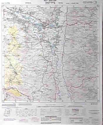
Topographical map with a partial overprint of place names in order to facilitate its use by readers who are not familiar with the Hebrew alphabet. |
||

Click on the photo at the left to examine the detail of this map. Bet-She'an (Tell al-Husn), ancient Scythopolis, lies at a main crossroads leading to Jerusalem (across the Jordan Valley) and to Gilead in the Transjordan (across the Jezreel Valley). This strategic location and the fertility of its farm land, due to a continual supply of water from the Harod River, gave Bet-She'an some prominence among the ancient cities of Syro-Palestine. |
||
![]()
![]()
![]()
![]()
Thank you for visiting BIBARCH™.
Page last updated: 02/05/01 05:26 AM.